
Due to weather conditions, the start time for tonight’s Independence Day fireworks display at TPA Park in Frankfort has been pushed back to 11:00-11:15 p.m. at this time.
Organizers and emergency officials continue to monitor the weather closely. The fireworks are still planned for tonight, and officials say they will not move the display to the Sunday rain date unless emergency services determine there is too much lightning in the area or conditions become unsafe.
If additional delays or changes become necessary, they will be announced as soon as possible.
For the latest updates throughout the evening, keep it tuned to AM 1570 and 96.9 WILO and Boone’s Best 102.7, and follow Clinton County Daily News, Boone County Daily News, and Carroll County Daily News.
]]>
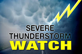
THE NATIONAL WEATHER SERVICE HAS EXTENDED SEVERE THUNDERSTORM WATCH 455 TO INCLUDE THE FOLLOWING AREAS UNTIL 8 PM EDT THIS EVENING IN INDIANA THIS WATCH INCLUDES 8 COUNTIES IN CENTRAL INDIANA BOONE CLINTON HAMILTON HENDRICKS MARION IN WEST CENTRAL INDIANA MONTGOMERY PUTNAM TIPPECANOE THIS INCLUDES THE CITIES OF BROWNSBURG, CARMEL, CRAWFORDSVILLE, DANVILLE, FISHERS, FRANKFORT, GREENCASTLE, INDIANAPOLIS, LAFAYETTE, LEBANON, NOBLESVILLE, PLAINFIELD, WEST LAFAYETTE, AND ZIONSVILLE.
* AFFECTED AREAS: BOONE, IN … CLINTON, IN … HAMILTON, IN … HENDRICKS, IN … MARION, IN … MONTGOMERY, IN … PUTNAM, IN … TIPPECANOE, IN
]]>
FROM THE NATIONAL WEATHER SERVICE
A HEAT ADVISORY REMAINS IN EFFECT FROM NOON TODAY TO 8 PM EDT
THURSDAY…
* WHAT…Heat index values up to 108 expected.
* IMPACTS…Hot temperatures and high humidity may cause heat
illnesses.
PRECAUTIONARY/PREPAREDNESS ACTIONS…
Drink plenty of fluids, stay in an air-conditioned room, stay out of
the sun, and check up on relatives and neighbors.
To reduce risk during outdoor work, the Occupational Safety and
Health Administration recommends scheduling frequent rest breaks in
shaded or air conditioned environments. Anyone overcome by heat
should be moved to a cool and shaded location. Heat stroke is an
emergency! Call 9 1 1.
FROM THE HUMANE SOCIETY
]]>
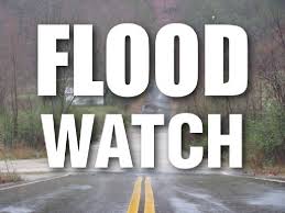
A Flood Watch is in effect until 4:00am Thursday June 18th for the following counties
Carroll-Warren-Tippecanoe-Clinton-Howard-Fountain-Montgomery-
Boone-Tipton-Hamilton-Madison-Delaware-Randolph-Vermillion-Parke-
Putnam-Hendricks-Marion-Hancock-Henry-Vigo-Clay-Owen-Morgan-
Johnson-Shelby-Rush-Sullivan-Greene-Monroe-Brown-Bartholomew-
Decatur-Knox-Daviess-Martin-Lawrence-Jackson-Jennings-
Including the cities of Veedersburg, Vincennes, Lebanon,
Nashville, West Lebanon, Gosport, Greensburg, Crawfordsville,
Rosedale, Greencastle, Shelburn, Shelbyville, Greenfield,
Bedford, Parker City, Mooresville, Fairview Park, Worthington,
Winchester, Loogootee, Shoals, Farmland, North Vernon, Carmel,
Noblesville, Attica, Plainfield, Muncie, Martinsville, Greenwood,
Columbus, Danville, Brazil, Jasonville, Sullivan, Lafayette,
Tipton, Montezuma, Rushville, New Castle, Spencer, Clinton,
Washington, Brownsburg, Anderson, Covington, Delphi, Mitchell,
Seymour, Indianapolis, Terre Haute, Kokomo, Zionsville, Union
City, Rockville, Bloomington, West Lafayette, Williamsport,
Flora, Fishers, Franklin, Farmersburg, Bloomfield, Linton,
Frankfort, and Carlisle
..FLOOD WATCH IN EFFECT FROM 5 PM EDT THIS AFTERNOON THROUGH 4:00am Thursday
* WHAT…Flooding caused by excessive rainfall is possible.
* WHERE…All of Central Indiana.
* WHEN…From 5 PM EDT this afternoon until 4:00am Thursday
* IMPACTS…Excessive runoff may result in flooding of rivers,
creeks, streams, and other low-lying and flood-prone locations.
* ADDITIONAL DETAILS…
– Total rainfall of 1-2 inches is expected with locally higher
amounts in excess of 4 inches.
– http://www.weather.gov/safety/flood
PRECAUTIONARY/PREPAREDNESS ACTIONS…
You should monitor later forecasts and be alert for possible Flood
Warnings. Those living in areas prone to flooding should be prepared
to take action should flooding develop.
]]>
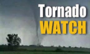
The National Weather Service has issued a Tornado Watch until 1:00am Thursday, June 18th for the following counties
BARTHOLOMEW BLACKFORD BOONEBROWN CARROLL CASS
CLAY CLINTON DAVIESS DECATUR DELAWARE FOUNTAIN
GRANT GREENE HAMILTON HANCOCK HENDRICKS HENRY
HOWARD HUNTINGTON JACKSON JAY JENNINGS JOHNSON
KNOX LAWRENCE MADISON MARION MARTIN MIAMI
MONROE MONTGOMERY MORGAN OWEN PARKE PUTNAM
RANDOLPH RUSH SHELBY SULLIVAN TIPPECANOE TIPTON
VERMILLION VIGO WABASH WARREN WHITE
Another round of storms will be moving through until the early
overnight hours with a Tornado Watch in effect until 1am EDT. Damaging
winds, large hail, tornadoes, and heavy rain are all possible.
Outside of thunderstorms, winds will gust to around 40 mph this
evening.
.SPOTTER INFORMATION STATEMENT…
Spotter activation is requested into the early overnight hours.
More information, along with other weather, hydrological and climate
information can be found at http://weather.gov/ind
]]>

FOR IMMEDIATE RELEASE: The City of Frankfort Board of Public Works & Safety Places
Officer on Administrative Leave Without Pay
For additional information, please contact:
Mayor Judy Sheets, City of Frankfort
jsheets@frankfort-in.gov
FRANKFORT, IN (June 17, 2026) – The City of Frankfort Board of Public Works and Safety
convened today and voted to place Frankfort Police Officer Ethan Cunningham on
administrative leave without pay, effective immediately.
The Board’s decision follows a formal recommendation submitted by Frankfort Police Chief
Scott Shoemaker. The unpaid administrative leave will remain in effect pending the outcome
and results of Officer Cunningham’s upcoming criminal trial. Indiana Code provides that an
officer may be placed on unpaid administrative leave, but any alternative disciplinary actions
must be stayed until the conclusion of the criminal case.
In a separate but related matter during the meeting, Chief Shoemaker requested and received
approval from the Board to begin exploring options to rehome K9 Taz. The City of Frankfort has
been boarding Taz at the city’s expense since the initial incident occurred.
“Given the nature of the situation and the pending legal proceedings, this administrative action
is necessary and appropriate while the judicial process takes its course,” stated Mayor Judy
Sheets. Additionally, our priority with K9 Taz is finding the best possible long-term solution for
his care and well-being.”
Because this remains an active legal and personnel matter, the City of Frankfort cannot
comment regarding the specifics any internal investigation or the pending criminal case at this
time.
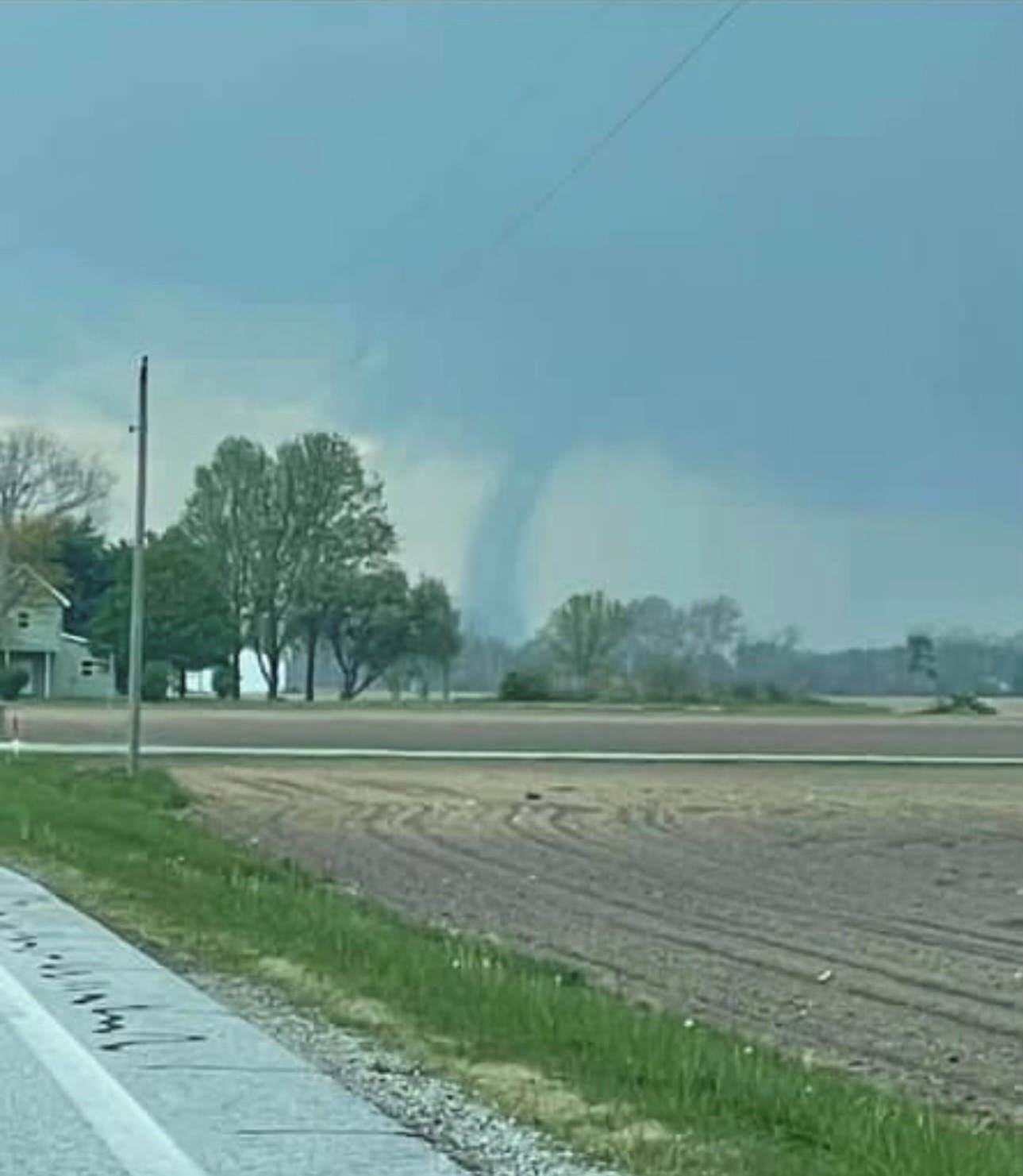 The National Weather Service in Indianapolis has issued a
* Tornado Warning for… Southeastern Tippecanoe County in west central Indiana… Western Clinton County in central Indiana… Northwestern Boone County in central Indiana… Northern Montgomery County in west central Indiana…
* Until 1000 PM EDT.
* At 929 PM EDT, a severe thunderstorm capable of producing a tornado was located 9 miles northwest of Crawfordsville, moving east at 60 mph. HAZARD…Tornado. SOURCE…Radar indicated rotation. IMPACT…Flying debris will be dangerous to those caught without shelter. Mobile homes will be damaged or destroyed. Damage to roofs, windows, and vehicles will occur. Tree damage is likely.
* Locations impacted include… Frankfort, Thorntown, Mulberry, Linden, Colfax, Clarks Hill, and New Richmond. This includes Interstate 65 between mile markers 148 and 164.
* AFFECTED AREAS: BOONE, IN … CLINTON, IN … MONTGOMERY, IN … TIPPECANOE, IN
Instructions:
]]>
* AFFECTED AREAS: BOONE, IN … CARROLL, IN … CLINTON, IN … FOUNTAIN, IN … HOWARD, IN … MONTGOMERY, IN … PARKE, IN … TIPPECANOE, IN … TIPTON, IN … VERMILLION, IN … WARREN, IN
]]>From the National Weather Service
A SEVERE THUNDERSTORM WATCH 306 IS IN EFFECT UNTIL 1100 PM EDT
FOR THE FOLLOWING LOCATIONS


.    INDIANA COUNTIES INCLUDED ARE

ADAMS                ALLEN               BLACKFORD
BOONE                CARROLL             CASS
CLINTON              DE KALB             ELKHART
FOUNTAIN             FULTON              GRANT
HOWARD               HUNTINGTON          JAY
KOSCIUSKO            LAGRANGE            LA PORTE
MARSHALL             MIAMI               MONTGOMERY
NOBLE                PULASKI             ST. JOSEPH
STARKE               STEUBEN             TIPPECANOE
TIPTON               VERMILLION          WABASH
WARREN               WELLS               WHITE
WHITLEY
. INDIANA COUNTIES INCLUDED ARE
ADAMS ALLEN BLACKFORD
BOONE CARROLL CASS
CLINTON DE KALB ELKHART
FOUNTAIN FULTON GRANT
HOWARD HUNTINGTON JAY
KOSCIUSKO LAGRANGE LA PORTE
MARSHALL MIAMI MONTGOMERY
NOBLE PULASKI ST. JOSEPH
STARKE STEUBEN TIPPECANOE
TIPTON VERMILLION WABASH
WARREN WELLS WHITE
WHITLEY
Scattered showers and thunderstorms are possible into the overnight
tonight. Strong gusty winds, localized flooding, and cloud to ground
lightning are the primary hazards.
]]>

The National Weather Service has issued the following informational statement concerning our first chance of high heat indexes this season.
NWS
Early season heat is upon us, with forecasted high temperatures
for today and Thursday near 90 degrees. Dew points into the 70s
will bring heat indexes to between 95 to 104 degree range during
peak heating both days.
Use the following safety tips for facing the heat safely:
* Stay hydrated, avoiding alcohol and drinks with heavy
caffeine or sugar.
* Dress in loose fitting clothing, light in color.
* Take advantage of shade and air conditioning when possible.
* Take frequent breaks when working outdoors.
* Beware that automobiles heat up very quickly, thus pets and
children should not be left in parked vehicles for any length
of time.
* Vulnerable populations are particularly at risk: elderly,
infants, and people with chronic medical conditions.
For more information about heat, visit weather.gov/safety/heat.
]]>