
 The National Weather Service in Indianapolis has issued a
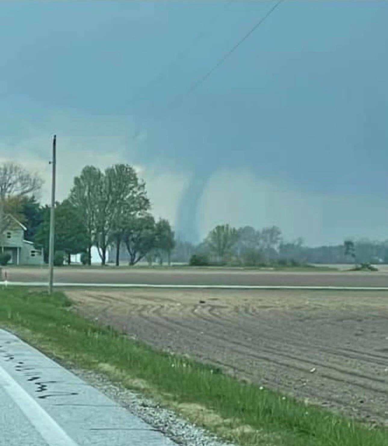
* Tornado Warning for… Southeastern Tippecanoe County in west central Indiana… Western Clinton County in central Indiana… Northwestern Boone County in central Indiana… Northern Montgomery County in west central Indiana…
* Until 1000 PM EDT.
* At 929 PM EDT, a severe thunderstorm capable of producing a tornado was located 9 miles northwest of Crawfordsville, moving east at 60 mph. HAZARD…Tornado. SOURCE…Radar indicated rotation. IMPACT…Flying debris will be dangerous to those caught without shelter. Mobile homes will be damaged or destroyed. Damage to roofs, windows, and vehicles will occur. Tree damage is likely.
* Locations impacted include… Frankfort, Thorntown, Mulberry, Linden, Colfax, Clarks Hill, and New Richmond. This includes Interstate 65 between mile markers 148 and 164.
* AFFECTED AREAS: BOONE, IN … CLINTON, IN … MONTGOMERY, IN … TIPPECANOE, IN
Instructions: